Within Sardinia
What Modern Technology Looks Like a UFO?
Many recent Sardinian UFO reports become less mysterious when compared with drones, satellite trains and aircraft seen under difficult conditions.
On this page
- How drones distort distance and motion
- Why satellites and aircraft create convincing illusions
- A practical checklist for testing a sighting
Page outline Jump by section
Introduction
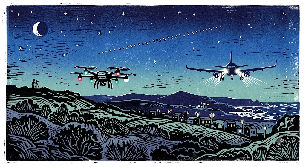
Many recent “UFO” sightings in Sardinia are best understood as identification problems rather than evidence of extraordinary craft. Drones can hover, reverse direction and change their apparent speed; satellite trains can cross the island as precisely spaced chains of lights; and aircraft approaching head-on can seem motionless before suddenly turning or fading. Sardinia makes these effects especially convincing because much of the island offers dark horizons, open sea, sparse ground lighting and extensive civil and military aviation.
This does not mean every report is automatically solved. Some lack the time, direction or original files needed for a proper reconstruction. The important change is that modern technology has created a much larger range of plausible explanations. In 2021, the National UFO Centre attributed 30 per cent of the Italian reports it analysed to Starlink satellites, 7 per cent to aircraft or helicopters and 4 per cent to drones. Only two of that year’s reports came from Sardinia, but the national pattern shows what investigators must now test first.[L'Unione Sarda.it]unionesarda.itnel 2021 avvistati due ufo nei cieli della sardegna mi5frdraA proposito della tipologia delle 166 segnalazioni analizzate dal Cun, il 30% è consistito in avvistamenti di satelliti Starlink; il 28%…
How drones distort distance and motion
A drone is a particularly effective source of mistaken sightings because it combines aircraft-like lights with movements that conventional aircraft do not normally make. It can stop, hover, move sideways, climb almost vertically and return along the same path. At night, when its body and propellers disappear against the sky, the witness sees only one or more lights and has little information from which to judge its size or distance.
That missing scale is crucial. A small drone a few hundred metres away may be interpreted as a large object several kilometres distant. Once the observer makes that unconscious assumption, modest drone movements appear to imply enormous speeds. A light crossing several degrees of sky in a second is not necessarily moving unusually fast: the same angular movement can be produced by a nearby slow object or a distant fast one.
Drone lighting can also create misleading changes in shape. A multicopter turning around may reveal different navigation lights, making one point appear to divide into two or three. A bright forward-facing lamp can disappear when the craft rotates, producing the impression that the object extinguished itself. Automatic exposure and digital zoom may enlarge each light into a glowing disc, diamond or “orb”, while camera shake gives it a jagged trajectory that was not present in the sky.
Night operations are not inherently suspicious. Italian aviation rules envisage drones flying after dark and require suitable lighting for operations conducted within visual line of sight. The lights must allow the pilot to recognise the drone’s position and orientation and, where relevant, make it visible to other airspace users. ENAC, Italy’s civil aviation authority, also publishes geographical restrictions through the D-Flight system, including limitations near airports, protected areas and other sensitive airspace.[ENAC]enac.gov.itOpen source on enac.gov.it.
In Sardinia, legitimate drones may be used for photography, surveying, emergency work, environmental monitoring and firefighting. The island’s forestry and civil-protection services, for example, use unmanned aircraft to locate active fire fronts and hotspots during containment and post-fire operations. Such flights may occur over dark rural terrain where an observer has no visible pilot, road or building to provide context.[ANSA.it]ansa.itNell'Oristanese droni con l'IA per contrastare il fuocoIl Servizio territoriale della protezione civile regionale di Oristano, assieme al nucleo Uas (Unmanned Aircraft System) della Protezione…
A drone explanation becomes stronger when the reported object:
- remains within a limited area rather than travelling continuously across the sky;
- hovers, makes repeated short movements or returns to a previous position;
- appears below or against clouds;
- produces a faint buzzing sound after initially seeming silent;
- shows red, green or white lights that alter as it turns;
- is observed near an event, fire, construction project, coastline survey or scenic filming location.
None of those features proves that the object was a drone. Windblown balloons, helicopters and visual effects can overlap with them. The strongest confirmation would come from original video containing fixed landscape references, several witnesses at separated positions, or information about authorised operations in the area.
Why satellite trains look organised and unnatural
Satellites usually appear as steady points moving smoothly across the stars. They do not carry visible lamps for observers on the ground; they are seen because they reflect sunlight. This is why low-orbit satellites are most conspicuous after sunset or before sunrise, when the observer is in darkness but the spacecraft remains illuminated high above Earth. The International Space Station is visible for the same reason and may vanish partway across the sky when it enters Earth’s shadow.[NASA]nasa.govSpot the Station Frequently Asked QuestionsThe best viewing experience for station is typically during twilight or nighttime…. The International Space Station is visible because…
Starlink launches created a more dramatic version of this familiar effect. Shortly after deployment, numerous satellites travel in a relatively compact sequence. Seen from below, they resemble a luminous train, a dotted line or a procession of objects maintaining exact spacing. That ordered formation can feel more artificial—and therefore more mysterious—than a single satellite, particularly to someone encountering it for the first time.
Sardinia has already experienced island-wide confusion of this kind. In one widely reported passage, residents from Sassari to Cagliari saw a chain of lights moving from west towards the south-east shortly after 19:00. Local reporting quickly identified it as Starlink, rather than an unexplained regional event. A Sardinian investigator later noted that many videos circulated from the north of the island in 2023 also showed Starlink constellations.[L'Unione Sarda.it]unionesarda.itOpen source on unionesarda.it.
Several details make satellite sightings seem stranger than they are:
Abrupt disappearance. A satellite may fade rapidly when it enters Earth’s shadow. To the witness it can look as though a luminous object has switched off or accelerated away, although no unusual manoeuvre occurred.
Different brightness within one train. Individual satellites can reflect different amounts of sunlight because of their attitude, design or position. A chain may therefore contain bright points, faint points and apparent gaps.
Apparent changes in formation. Perspective compresses or stretches the spacing as the train approaches, passes overhead and recedes. Thin cloud can hide some members temporarily, creating the impression that lights have merged, separated or appeared from nowhere.
Phone-camera streaks. Long exposure, night mode and movement of the handset can turn point sources into dashes, curves or parallel trails. The resulting recording may be visually more dramatic than the naked-eye observation.
Astronomical research confirms that satellite constellations have become a much more common presence in twilight imagery. A study of observations made by the Zwicky Transient Facility identified more than 5,300 Starlink streaks between late 2019 and September 2021 and found that the proportion of affected twilight images increased sharply as the constellation grew. That research concerned telescope photographs rather than Sardinian witness reports, but it demonstrates the scale of the new identification problem.[arXiv]arxiv.orgOpen source on arxiv.org.
A line of evenly spaced lights following one continuous course is therefore among the easiest modern sightings to test. The exact date, time, viewing location and direction can be compared with historical satellite predictions. A close match usually provides a substantially stronger explanation than impressions of unusual speed or formation gathered without distance information.
Aircraft that hover, split or vanish
Conventional aircraft remain one of the most persistent sources of convincing UFO reports. The problem is not that witnesses have never seen an aeroplane. It is that an aircraft viewed under an unfamiliar geometry may look very different from the side-on silhouette people expect.
An aircraft approaching almost directly towards an observer produces little sideways movement. Its landing lights may brighten for minutes while the airframe remains invisible, creating the impression of a stationary object hovering in the distance. When the aircraft turns onto another heading, the light may suddenly move sideways, dim sharply or reveal several navigation lights. A single “orb” can thus seem to transform into a triangular or multi-light object.
The reverse occurs when an aircraft flies away. Its lights may become progressively fainter without an obvious change in position, then disappear through haze or behind a ridge. Banking can conceal one wingtip light while revealing another. Flashing anti-collision lights may also be recorded irregularly by a phone, especially when frames are dropped or exposure changes automatically.
Sardinia’s geography strengthens these illusions. Observations across the sea or over sparsely populated land provide few reference points for judging altitude and range. Aviation safety material warns that distance, speed and depth are inferred from cues such as known object size, relative motion, texture and contrast. These cues are lost over water, at night and in low visibility.[Federal Aviation Administration]faa.govFederal Aviation Administration
A related effect is autokinesis. When a person stares at an isolated point of light against a dark, featureless background, the light may seem to drift even when it is stationary. The effect is sufficiently real to be included in pilot safety guidance because it can cause a star or ground light to appear to move. In a civilian sighting, the witness may sincerely report zigzags, sudden deviations or small circular movements that were produced partly by involuntary eye movements and the lack of a stable visual reference.[Federal Aviation Administration]faa.govFederal Aviation Administration
Helicopters add another layer of ambiguity. They can hover, turn tightly, operate at lower altitude and direct powerful searchlights towards the ground. Survey flights may also trace repeated lines or circles that appear purposeless to an observer. In Sardinia, specialised aircraft and helicopters are used for rescue exercises, geophysical work, firefighting and coastal or environmental surveys. Public curiosity has sometimes ended only when the operator or purpose was reported.[lanuovasardegna.it]lanuovasardegna.itLa Nuova Sardegna Aereo sulle coste della Sardegna: ecco che cosa sta facendoLa Nuova Sardegna Aereo sulle coste della Sardegna: ecco che cosa sta facendo
Military activity deserves consideration without becoming a catch-all explanation. Sardinia contains major training areas and sees Italian and allied aircraft whose routes, lighting or manoeuvres may be unfamiliar. Yet “military aircraft” should not be used merely because a sighting occurred near a base. A credible match still requires compatible timing, direction, duration and operating area.
Why a flight-tracking app cannot settle every case
Checking an aircraft-tracking service is useful, but the absence of a symbol on the screen does not prove that a light was not an aircraft. Public tracking sites primarily depend on signals transmitted by aircraft and received by ground or satellite networks. Coverage, equipment and display policies vary, and some military or government aircraft may be limited or omitted. Flightradar24 itself states that many military aircraft use different transponder arrangements and that some government or military traffic may be blocked entirely.[Flightradar24]flightradar24.comOpen source on flightradar24.com.
Small aircraft and helicopters may also be missed when flying low beyond good receiver coverage. Tracking data can contain errors caused by radio limitations, interference, weather, onboard configuration or incorrect position information. Therefore, “nothing appeared on the app” is a useful observation, not a definitive exclusion.[Flightradar24]mobile.flightradar24.comOpen source on flightradar24.com.
The reverse mistake is matching the sighting to the nearest displayed aircraft without checking geometry. A flight may appear close on a flat map while actually lying far from the witness’s line of sight. A proper comparison should consider:
- the witness’s exact position;
- the direction and elevation of the light;
- the aircraft’s altitude and heading;
- the observation’s start and end times;
- whether terrain or buildings would have blocked the view;
- whether the aircraft’s lights and apparent movement fit the description.
Historical data are preferable to a screenshot taken several minutes later. Aircraft can cover large distances while witnesses discuss what they saw or open an app.
A practical checklist for testing a sighting
A modern Sardinian sighting is most useful when it preserves information that can be checked. A shaky close-up of a light may appear impressive, but a wider recording showing the horizon, stars, buildings or hills provides far more evidence.
Record the basics immediately. Note the date and precise local time, the municipality or coordinates, the direction faced, the object’s approximate height above the horizon and the direction in which it travelled. Avoid replacing these details with descriptions such as “over the sea” or “towards the mountains”.
Keep the original file. Social-media platforms compress video and remove metadata. The unedited photograph or recording may preserve capture time, exposure information and a wider field of view. Do not add stabilisation, filters or drawn trajectories before making a copy of the original.
Film a reference view. Zoom out for several seconds. Include a roofline, tree, road sign, coastline or bright star. If safe, brace the phone against a fixed object. Apparent darting that stops when the camera is steadied is evidence of handset movement, not aerial manoeuvring.
Check satellites first when motion is smooth. A steadily moving point, a straight procession of lights or an object that fades without turning should be compared with satellite predictions. A sudden disappearance can indicate entry into Earth’s shadow rather than acceleration.
Check aircraft, but note the limits. Review historical flight tracks for the correct time and location. Search more than one service where possible, and do not treat missing public data as proof that no aircraft was present.
Consider drones when the area is localised. Hovering, repeated passes, tight direction changes and shifting coloured lights are consistent with a nearby unmanned aircraft. Look for events, emergency operations, fires, surveying or filming activity—but do not confront a suspected operator or attempt to interfere with the flight.
Compare accounts separately. Ask each witness to write or sketch what was seen before discussing interpretations. Agreement reached after people have watched the same enlarged video is less valuable than independent agreement on direction, timing and movement.
Look for parallax. If the observer was in a moving car, a distant light can appear to move relative to nearby trees, poles and buildings. Reflections in the windscreen can also track with the camera or vanish when the viewing angle changes.
Leave room for an honest unknown. A report may remain unidentified simply because the necessary information was never recorded. “Unresolved” does not mean “extraordinary”; it means that the available evidence does not discriminate reliably among the remaining explanations.
What these explanations change in Sardinia’s UFO record
Modern technology has not ended unusual sightings in Sardinia. It has changed the standard of evidence needed to make one persuasive. A light’s ability to hover is no longer remarkable by itself because drones routinely hover. A formation of evenly spaced objects is not compelling without a satellite check. An object absent from one flight-tracking app is not automatically outside aviation. Rapid movement in a magnified phone video may reveal more about camera shake and missing distance cues than about the object’s actual speed.
This makes recent reports more testable but also more fragile. Exact timestamps can identify a Starlink pass; preserved video can distinguish movement in the sky from movement of the phone; and flight records can support or weaken an aircraft explanation. Conversely, a clip detached from its original time, place and horizon may remain impossible to resolve, however unusual it appears.
For Sardinia’s wider UFO history, the strongest modern cases will be those that survive these ordinary checks rather than those that merely look strange online. Multiple independent viewpoints, original files, accurate directions, radar or operational information and a documented elimination of drones, satellites and aircraft would materially strengthen a report. Until those elements exist, the island’s dark and active skies provide a powerful reason for caution: they make modern objects easier to see, but not necessarily easier to recognise.
Amazon book picks
Further Reading
Books and field guides related to What Modern Technology Looks Like a UFO?. Use these as the next step if you want deeper reading beyond the article.
The Drone Pilot's Handbook
The perfect companion for anyone buying (or thinking of buying) a drone, whether it's just for fun, to race against friends, or to give t...
NightWatch: A Practical Guide to Viewing the Universe
A practical guide to viewing the universe.
Jane's Aircraft Recognition Guide
Profiles nearly five hundred civil and military jets, helicopters, and other aircraft, providing color photos, multi-angle drawings, brie...
The Backyard Astronomer's Guide
Discusses the practical aspects of stargazing, including how to choose appropriate equipment, contending with light pollution, taking suc...
eBay marketplace picks
Marketplace Samples
Live-tested eBay searches with available results related to this page.
Selected fromUFO poster oneBay.co.uk.
Current eBay listing
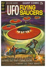
VINTAGE UFO FLYING SAUCERS COMIC ADVERTISING A2 POSTER PRINT
Current eBay listing
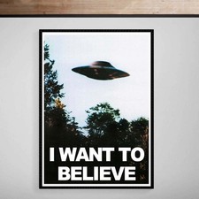
I Want To Believe UFO Poster Giclée Fine Art Heavyweight Print


Endnotes
1.
Source: enac.gov.it
Link:https://www.enac.gov.it/app/uploads/2024/04/Regolamento_APR_Ed_3_Emend_1.pdf
2.
Source: enac.gov.it
Link:https://www.enac.gov.it/sicurezza-aerea/droni/zone-geografiche-space/voli-con-droni-uas-limitazioni-riserve-dello/
Source snippet
793, “Divieti di sorvolo”, stabilisce che l'Enac “può vietare il sorvolo su determinate zone del territorio nazionale per...Read more...
3.
Source: ansa.it
Title: Nell’Oristanese droni con l’IA per contrastare il fuoco
Link:https://www.ansa.it/sardegna/notizie/2026/07/14/nelloristanese-droni-con-lia-per-contrastare-il-fuoco_8e64c74f-ce58-4b30-9546-0539b233737a.html
Source snippet
Il Servizio territoriale della protezione civile regionale di Oristano, assieme al nucleo Uas (Unmanned Aircraft System) della Protezione...
4.
Source: nasa.gov
Title: Spot the Station Frequently Asked Questions
Link:https://www.nasa.gov/missions/station/spot-the-station-frequently-asked-questions/
Source snippet
The best viewing experience for station is typically during twilight or nighttime.... The International Space Station is visible because...
5.
Source: spotthestation.nasa.gov
Title: Frequently Asked Questions | Spot The Station | NASAE.g
Link:https://spotthestation.nasa.gov/faq.cfm
Source snippet
Time: Mon Jul 15 11:57 PM, Visible: 2 min, Max Height: 51°, Appears: 51° above ENE, Disappears: 11° above ENE... This typically happens...
6.
Source: arxiv.org
Link:https://arxiv.org/abs/2201.05343
7.
Source: faa.gov
Title: Federal Aviation Administration
Link:https://www.faa.gov/pilots/safety/pilotsafetybrochures/media/spatiald_visillus.pdf
8.
Source: ingv.it
Link:https://www.ingv.it/stampa-urp/ufficio-stampa/comunicati-stampa/einstein-telescope-un-elicottero-in-volo-per-indagare-il-sottosuolo-dellarea-candidata-a-ospitare-il-futuro-osservatorio-di-onde-gravitazionali
9.
Source: ingv.it
Link:https://www.ingv.it/stampa-urp/ufficio-stampa/note-stampa/einstein-telescope-completati-i-sorvoli-in-elicottero-per-studiare-il-sottosuolo-della-barbagia
10.
Source: flightradar24.com
Link:https://www.flightradar24.com/how-it-works
11.
Source: mobile.flightradar24.com
Link:https://mobile.flightradar24.com/mobile/terms
12.
Source: cnsas.sardegna.it
Title: tortoli esercitazione internazionale grifone 2026
Link:https://cnsas.sardegna.it/2026/05/tortoli-esercitazione-internazionale-grifone-2026/
13.
Source: ingv.it
Link:https://ingv.it/en/urp-press/Press-office/press-notes/Einstein-Telescope-completed-helicopter-flyovers-to-study-the-Barbagia-subsoil
14.
Source: ingv.it
Link:https://www.ingv.it/de/urp-dr%C3%BCcken/Presseb%C3%BCro/Stempel-kommunizieren/Einstein-Teleskop%3A-Ein-Hubschrauber-im-Flug-zur-Untersuchung-des-Untergrunds-des-Gebiets–das-als-Standort-f%C3%BCr-das-zuk%C3%BCnftige-Gravitationswellenobservatorium-vorgeschlagen-wurde
15.
Source: nasa.gov
Title: Sunglint on Atlantic Ocean
Link:https://www.nasa.gov/image-article/sunglint-on-atlantic-ocean/
16.
Source: flightradar24.com
Title: How does Flightradar24 track aircraft? | Flightradar24 Blog
Link:https://www.flightradar24.com/blog/inside-flightradar24/how-does-fr24-track-aircraft/
17.
Source: nasa.gov
Link:https://www.nasa.gov/general/nasa-satellites-see-upper-atmosphere-cooling-and-contracting-due-to-climate-change/
18.
Source: science.nasa.gov
Title: high dry and rare in the sky 148502
Link:https://science.nasa.gov/earth/earth-observatory/high-dry-and-rare-in-the-sky-148502/
19.
Source: flightradar24.com
Title: How We Track Flights with ADS-B | Flightradar24 Blog
Link:https://www.flightradar24.com/blog/inside-flightradar24/how-we-track-flights-with-ads-b/
20.
Source: science.nasa.gov
Title: the science of sunglint 84333
Link:https://science.nasa.gov/earth/earth-observatory/the-science-of-sunglint-84333/
21.
Source: science.nasa.gov
Title: earthshine 83782
Link:https://science.nasa.gov/earth/earth-observatory/earthshine-83782/
22.
Source: science.nasa.gov
Title: how to interpret a false color satellite image
Link:https://science.nasa.gov/earth/earth-observatory/how-to-interpret-a-false-color-satellite-image/
23.
Source: science.nasa.gov
Title: catalog of earth satellite orbits
Link:https://science.nasa.gov/earth/earth-observatory/catalog-of-earth-satellite-orbits/
24.
Source: science.nasa.gov
Title: noctilucent clouds
Link:https://science.nasa.gov/missions/aim/nasa-noctilucent-clouds/
25.
Source: science.nasa.gov
Title: noctilucent clouds 8366
Link:https://science.nasa.gov/earth/earth-observatory/noctilucent-clouds-8366/
26.
Source: science.nasa.gov
Title: research satellites for atmospheric sciences 1978 present
Link:https://science.nasa.gov/earth/earth-observatory/research-satellites-for-atmospheric-sciences-1978-present/
27.
Source: asrs.arc.nasa.gov
Title: cb 246
Link:https://asrs.arc.nasa.gov/publications/callback/cb_246.htm
28.
Source: flightradar24.com
Title: Automatic Dependent Surveillance
Link:https://www.flightradar24.com/how-it-works/ads-b
29.
Source: free.flightradar24.com
Link:https://free.flightradar24.com/how-it-works/ads-b
30.
Source: youtube.com
Title: Starlink Satellites Mistaken As UFOs Over Pittsburgh
Link:https://www.youtube.com/watch?v=1sMvdE8MfgA
31.
Source: unionesarda.it
Title: nel 2021 avvistati due ufo nei cieli della sardegna mi5frdra
Link:https://www.unionesarda.it/news-sardegna/nel-2021-avvistati-due-ufo-nei-cieli-della-sardegna-mi5frdra?amp=1
Source snippet
A proposito della tipologia delle 166 segnalazioni analizzate dal Cun, il 30% è consistito in avvistamenti di satelliti Starlink; il 28%...
32.
Source: unionesarda.it
Link:https://www.unionesarda.it/news-sardegna/i-satelliti-starlink-solcano-il-cielo-della-sardegna-ubt1kmye
33.
Source: lanuovasardegna.it
Link:https://www.lanuovasardegna.it/regione/2024/03/12/news/il-cacciatore-di-ufo-nei-cieli-della-sardegna-ho-raccolto-migliaia-di-segnalazioni-1.100488525
34.
Source: faa.gov
Link:https://www.faa.gov/air_traffic/publications/atpubs/aim_html/chap8_section_1.html
35.
Source: lanuovasardegna.it
Title: La Nuova Sardegna Aereo sulle coste della Sardegna: ecco che cosa sta facendo
Link:https://www.lanuovasardegna.it/regione/2026/06/04/news/aereo-sorvola-per-ore-le-coste-della-sardegna-svelato-il-mistero-ecco-che-cosa-sta-cercando-in-mare-1.100878310
36.
Source: lanuovasardegna.it
Link:https://www.lanuovasardegna.it/regione/2026/04/18/news/parla-l-esperto-di-dischi-volanti-la-mia-idea-puntare-sul-turismo-ufologico-nell-isola-si-puo-1.100858560
37.
Source: lanuovasardegna.it
Link:https://www.lanuovasardegna.it/regione/2025/10/29/news/ho-visto-un-missile-nel-cielo-tra-porto-torres-e-sassari-video-1.100782828
38.
Source: lanuovasardegna.it
Link:https://www.lanuovasardegna.it/video/video/sardegna/2025/10/29/video/ho-visto-un-missile-nel-cielo-di-sassari-le-immagini-del-misterioso-avvistamento-1.100782826
39.
Source: faa.gov
Title: AD S-B FAQ | Federal Aviation Administration
Link:https://www.faa.gov/air_traffic/technology/adsb/faq
40.
Source: unionesarda.it
Title: I satelliti Starlink solcano il cielo della Sardegna
Link:https://www.unionesarda.it/multimedia/i-satelliti-starlink-solcano-il-cielo-della-sardegna-xpsa3a94
41.
Source: faa.gov
Title: Chapter 8. Medical Facts for Pilots
Link:https://www.faa.gov/air_traffic/publications/atpubs/aim/aim0801.html
42.
Source: faa.gov
Title: Office of Aerospace Medicine Technical Reports | Federal Aviation Administration
Link:https://www.faa.gov/data_research/research/med_humanfacs/oamtechreports/1970s/1977/197712
43.
Source: enac.gov.it
Link:https://www.enac.gov.it/app/uploads/2024/09/syllabus-A1-A3-2024.pdf
44.
Source: enac.gov.it
Link:https://www.enac.gov.it/sites/default/files/allegati/2021-Dic/Allegato%20O%20-%20Argomenti%20esame%20teorico%20OPEN%20A2.pdf
45.
Source: enac.gov.it
Link:https://www.enac.gov.it/app/uploads/2024/04/Regolamento_ENAC_RAIT_ed_4_130521.pdf
46.
Source: enac.gov.it
Link:https://www.enac.gov.it/app/uploads/2024/04/ATM08.pdf
47.
Source: enac.gov.it
Title: Regolamento di Scalo Pescara Ed. 4 Rev.0 14.11.24 prot
Link:https://www.enac.gov.it/app/uploads/2024/11/Regolamento-di-Scalo-Pescara-Ed.-4-Rev.0-14.11.24-prot.pdf
48.
Source: enac.gov.it
Link:https://www.enac.gov.it/app/uploads/2024/12/RdS-Ed.-5.0_13dicembre2024.pdf
49.
Source: enac.gov.it
Title: Regolamento di Scalo Aeroporto di Cagliari
Link:https://www.enac.gov.it/app/uploads/2024/12/Regolamento-di-Scalo-Aeroporto-di-Cagliari.pdf
50.
Source: enac.gov.it
Title: CIRCOLARE Aeronautica Militare
Link:https://www.enac.gov.it/app/uploads/2022/02/Circolare_ATM08_20122018_rid.pdf
51.
Source: faa.gov
Link:https://www.faa.gov/sites/faa.gov/files/2022-01/Spatial%20Disorientation.pdf
52.
Source: faa.gov
Link:https://www.faa.gov/sites/faa.gov/files/regulations_policies/handbooks_manuals/aviation/airplane_handbook/12_afh_ch11.pdf
53.
Source: faa.gov
Link:https://www.faa.gov/sites/faa.gov/files/about/office_org/headquarters_offices/avs/SD_UAV-EV1.pdf
54.
Source: faa.gov
Link:https://www.faa.gov/sites/faa.gov/files/regulations_policies/handbooks_manuals/aviation/phak/19_phak_ch17.pdf
55.
Source: faa.gov
Link:https://www.faa.gov/sites/faa.gov/files/about/office_org/headquarters_offices/avs/MP-086-08.pdf
56.
Source: faa.gov
Title: FA A Safety Briefing
Link:https://www.faa.gov/sites/faa.gov/files/JanFeb2025.pdf
57.
Source: faa.gov
Link:https://www.faa.gov/sites/faa.gov/files/2022-01/NovDec2015.pdf
58.
Source: faa.gov
Link:https://www.faa.gov/sites/faa.gov/files/21_phak_glossary.pdf
59.
Source: faa.gov
Link:https://www.faa.gov/Air_traffic/publications/atpubs/aim_html/chap2_section_1.html
60.
Source: faa.gov
Link:https://www.faa.gov/air_traffic/publications/atpubs/aip_html/chap2_section_1.html
Additional References
61.
Source: sardegnaambiente.it
Title: Sardegna Ambiente Sardegna Corpo Forestale
Link:https://www.sardegnaambiente.it/index.php?c=4507&s=471808&t=1&v=2&xsl=612
Source snippet
Nella giornata odierna, il Nucleo UAS (Unmanned Aircraft System) della Direzione Generale del Corpo Forestale, coordinato dal Servizio Te...
62.
Source: youtube.com
Title: Drone swarm mystery and new UAP revelations | UFO Mysteries
Link:https://www.youtube.com/watch?v=JXB39hZ60RE
Source snippet
Train of Satellites in the Sky over California | Looks like UFOs | SpaceX Starlink Train 2023...
63.
Source: youtube.com
Title: NEW Drone / UAP / UFO Sightings EVERYWHERE! Is the Threat REAL?
Link:https://www.youtube.com/watch?v=v-NTE6U8dwQ
Source snippet
UFO or drone? Fear grows over mysterious aircraft in New Jersey...
64.
Source: youtube.com
Title: UFO or drone? Fear grows over mysterious aircraft in New Jersey
Link:https://www.youtube.com/watch?v=4uPagcaUXjs
Source snippet
Drone swarm mystery and new UAP revelations | UFO Mysteries...
65.
Source: facebook.com
Link:https://www.facebook.com/toiworldnews/videos/civilian-flights-were-suspended-at-sofiainternationalairport-as-us-military-airc/1852075552133221/
66.
Source: safeairspace.net
Link:https://safeairspace.net/
67.
Source: facebook.com
Link:https://www.facebook.com/joshhelfgott1/posts/spain-france-italy-and-switzerland-officially-close-their-airspace-to-us-militar/977585671438716/
68.
Source: support.fr24.com
Link:https://support.fr24.com/support/solutions/articles/3000117426-why-is-some-aircraft-information-limited-or-not-visible-
69.
Source: skybrary.aero
Link:https://skybrary.aero/index.php/articles/visual-illusions
70.
Source: sod.ivao.aero
Link:https://sod.ivao.aero/airspace_restrictions